 Rabaul Caldera
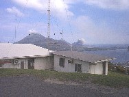
Rabaul caldera is a large volcanic structure on the northeastern
end of New Britain Island in Papua New Guinea. The volcano is famous
for the well developed ring-fault and the 1994 eruptions that destroyed
the town of Rabaul.
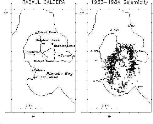
It is clear from the history of eruptions that there is
an interconnected plumbing system within the caldera. Eruptions in
1934 and 1994 had simultaneous activity at Vulcan and Tavurvur cones which
are on opposite sides of the caldera, separated by about 6 km.
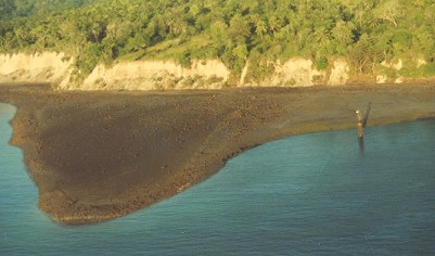
Exposed seafloor on Vulcan headlands caused by ~6 meter uplift
prior to eruption.
Note the tidegauge post on the right which is far out of the water.

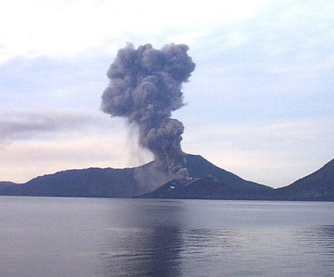
Composite photo taken by RVO staff of beginning of eruption
on September 18m 1994. Tavurvur on the east side of the
caldera (left)began erupting at 6:06 am and this picture shows the
begining of the Vulcan eruption on the west side of the
caldera (right) at about 7:20 am.
One important research issue is to understand the configuration
of the magma conduits within the volcano. The vents at Vulcan on
the west and Tavurvur on the east must be connected, either through narrow
pathways or a large central magma reservoir. Tomographic results
show a rather small low-velocity zone at shallow depths in the central
part of the caldera which is probably a source of magma, but it is still
uncertain if there is a large reservoir at greater depth underlying the
caldera.

Ash erupttions from Tavurvur on November 6, 2000.
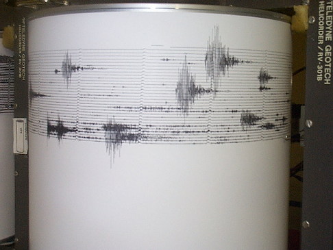
Earthquakes assoicated with explosions on November 6, 2000.

Rabaul Volcano Observatory Director, Ima Itikarai